Activity 1: Official Map of "Chinatown" in San Francisco (1885)
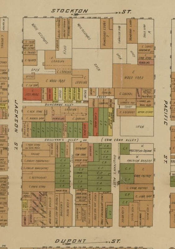
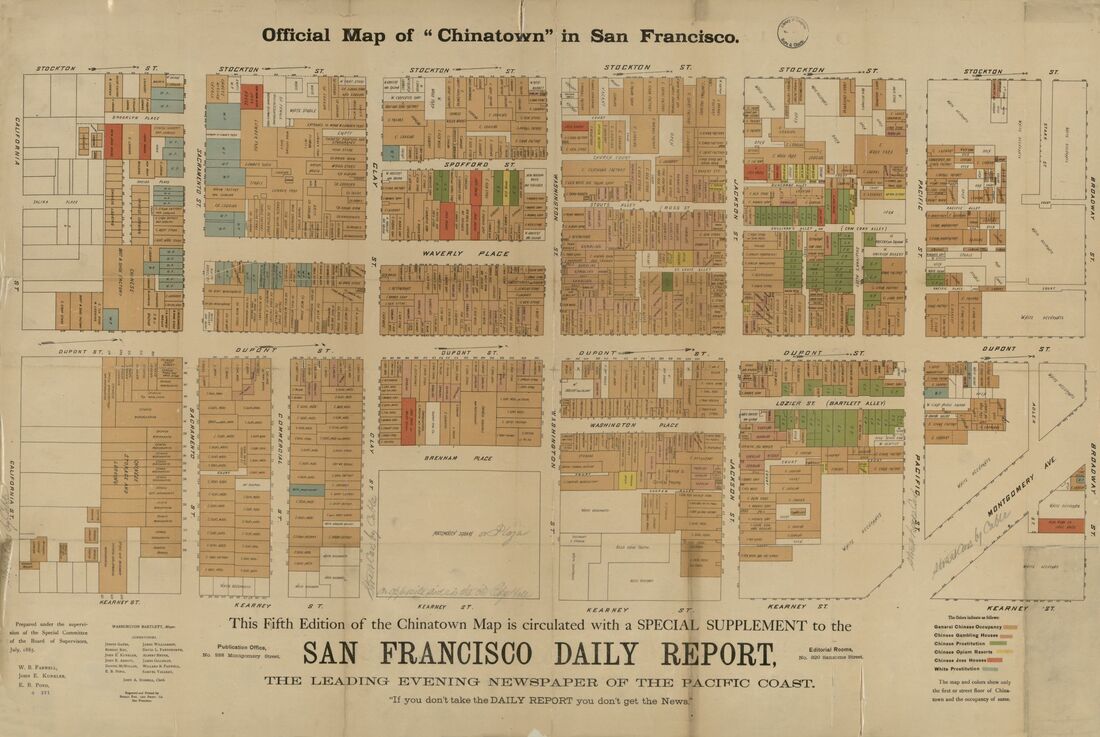
This map was created when a special survey was commissioned by the San Francisco government after multiple smallpox epidemics had broken out in the city. Chinese immigrants were targeted and blamed for spreading the epidemic, with little evidence. As part of this survey, officials entered every room and floor of Chinatown, noting elements like the number of inhabitants and sanitary condition of the rooms, which they described in an accompanying report on Chinatown for the public.

Map Legend:
Red rectangles = Joss House (Chinese temple or shrine)
Yellow rectangles = Opium Resort
Green rectangles = C.P. (Chinese Prostitution)
Pink rectangles = Gambling
Scroll down to see full map (source: Library of Congress, https://www.loc.gov/item/2012593519).


